Central US Weather: Extreme Temperature Swings & Weekend Outlook
Central US Weather Outlook: Navigating Extreme Temperature Swings This Weekend
The vast expanse of the Central United States is bracing for a weekend of truly dynamic and, in some areas, quite unusual weather patterns. From the frosty northern plains to the surprisingly mild southern reaches and the unique conditions in the Rockies, residents across this critical agricultural and economic heartland need to be prepared for a diverse array of meteorological phenomena. Our comprehensive forecast delves into the specifics, offering insights into what to expect, how to prepare, and the broader implications for daily life, travel, and agriculture.

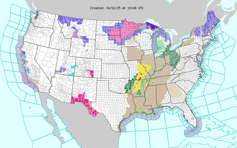
The image is a live image for the National Weather Service server. It gets updated on Real time.
Current Conditions & Regional Overview: A Tale of Two Winters
As we head into the evening hours of Saturday, December 13th, 2025, the Central Zone presents a striking contrast in temperatures and sky conditions. A broad ridge of high pressure appears to be influencing much of the region, leading to generally clear or partly cloudy skies for many, but with temperatures that vary wildly from north to south and even east to west. This atmospheric setup creates a fascinating, albeit challenging, scenario for residents and travelers alike.
Northern Plains and Upper Midwest: A True Winter Grip
Up in the northern reaches, winter has firmly established its presence. Cities like Minneapolis, MN, are experiencing frigid temperatures, hovering around 19°F (-7°C) this Saturday evening under partly cloudy skies. Further northwest, Fargo, ND, is even colder at a crisp 16°F (-9°C) with mostly clear conditions, setting the stage for a very cold night. Sioux Falls, SD, is also feeling the chill at 30°F (-1°C) with mostly clear skies, while Milwaukee, WI, reports a similar 30°F (-1°C) with clear skies. These areas are experiencing typical, albeit intense, December cold, reminding everyone of the season's full potential. Winds across this northern tier are generally moderate, ranging from 6 to 15 mph, contributing to a noticeable wind chill factor that makes the air feel even colder.
Central Corridor: A Mixed Bag of Conditions
Moving south into the central corridor, conditions become a little less extreme but still quite varied. Omaha, NE, is enjoying a relatively mild 45°F (7°C) this evening under clear skies, a pleasant reprieve compared to its northern neighbors. Des Moines, IA, is cooler at 34°F (1°C) with mostly clear conditions. Further east, Chicago, IL, is reporting 43°F (6°C) under mostly clear skies, but notably with brisk winds of 20 mph, making it feel cooler than the thermometer indicates. In Kansas City, MO, the evening is clear and mild at 55°F (13°C). These central states are experiencing a blend of early winter, with some areas still holding onto milder air masses while others are transitioning to colder, clearer conditions.
Southern & Eastern Central States: Unusual Warmth and Peculiar Precipitation
The southern and eastern parts of the Central Zone present some of the most intriguing weather. Wichita, KS, stands out with an exceptionally warm 64°F (18°C) this evening, accompanied by mostly cloudy skies and winds of 14 mph. This warmth extends eastward to St. Louis, MO, at 54°F (12°C) with mostly cloudy conditions. Even further east, Indianapolis, IN, is at 48°F (9°C) with mostly cloudy skies, and Detroit, MI, reports 54°F (12°C) and mostly cloudy weather. Perhaps the most peculiar report comes from Louisville, KY, where the temperature is a remarkably warm 68°F (20°C) but with
Comments
Post a Comment
Please leave a comment.